
Heissfeld topographic map
Interactive map
Click on the map to display elevation.
About this map
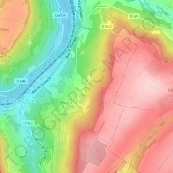
Name: Heissfeld topographic map, elevation, terrain.
Average elevation: 263 m
Minimum elevation: 142 m
Maximum elevation: 369 m
Other topographic maps
Click on a map to view its topography, its elevation and its terrain.
Mosel
Frankreich > Großer Osten > Rüsdorf
Mosel, Rüsdorf, Diedenhofen, Mosel, Großer Osten, Metropolitanes Frankreich, 57480, Frankreich
Average elevation: 318 m