
King Sabata Dalindyebo Ward 6 topographic map
Interactive map
Click on the map to display elevation.
About this map
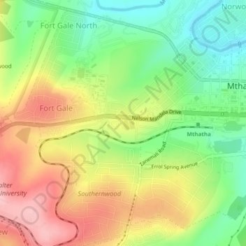
Name: King Sabata Dalindyebo Ward 6 topographic map, elevation, terrain.
Average elevation: 730 m
Minimum elevation: 657 m
Maximum elevation: 812 m
Other topographic maps
Click on a map to view its topography, its elevation and its terrain.
King Sabata Dalindyebo Ward 2
RSA > Eastern Cape > King Sabata Dalindyebo Local Municipality
King Sabata Dalindyebo Ward 2, King Sabata Dalindyebo Local Municipality, O.R. Tambo District Municipality, Eastern Cape, RSA
Average elevation: 716 m