
Mew topographic map
Interactive map
Click on the map to display elevation.
About this map
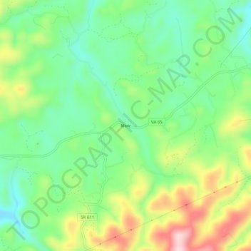
Name: Mew topographic map, elevation, terrain.
Location: Mew, Russell County, Virginia, United States (36.83927 -82.36292 36.87927 -82.32292)
Average elevation: 557 m
Minimum elevation: 458 m
Maximum elevation: 727 m
Other topographic maps
Click on a map to view its topography, its elevation and its terrain.