Geolocate

Oschersleben topographic map

Click on the map to display elevation.

About this map
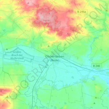
Name: Oschersleben topographic map, elevation, terrain.

Location: Oschersleben, Börde, Saxony-Anhalt, 39387, Germany (51.95572 11.12857 52.10909 11.40960)

Average elevation: 112 m

Minimum elevation: 72 m

Maximum elevation: 218 m

Gear up for your next adventure:

❄️Walking Crampons - Added traction for icy slopes and winter peak bagging
⌚GPS Outdoor Watches - Watches with GPS tracking for hiking and exploration
🥾Men's Waterproof Hiking Boots - Durable footwear with deep lugs for muddy and rocky UK terrains
🧊Insulated Flasks - Keeps drinks hot or cold during hikes
🧢Waterproof Hiking Hats - Keep the rain off your face while studying topographic maps

As an Amazon Associate, this site earns from qualifying purchases at no extra cost to you.