
Distrito Potrerillos topographic map
Interactive map
Click on the map to display elevation.
About this map
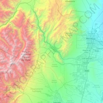
Name: Distrito Potrerillos topographic map, elevation, terrain.
Average elevation: 2,198 m
Minimum elevation: 645 m
Maximum elevation: 5,876 m
Other topographic maps
Click on a map to view its topography, its elevation and its terrain.
Distrito Ciudad de Luján de Cuyo
Argentina > Mendoza > Departamento Luján de Cuyo
Situated in the upper Mendoza valley, where the river is half-way through its journey from the Andes mountains to the eastern plains, many Lujan de Cuyo vineyards sit at altitudes of around 1000 m (3280 ft). Malbec in particular is successful in Lujan de Cuyo, but the appellation also produces good Cabernet…
Average elevation: 949 m
Luján de Cuyo
Argentina > Mendoza > Departamento Luján de Cuyo > Luján de Cuyo
Average elevation: 951 m