
Thank you for supporting this site ❤️
Make a donation
Make a donation
Gear up for your next adventure:
As an Amazon Associate, this site earns from qualifying purchases at no extra cost to you.
Moriello topographic map
Click on the map to display elevation.
Thank you for supporting this site ❤️
Make a donation
Make a donation
Gear up for your next adventure:
As an Amazon Associate, this site earns from qualifying purchases at no extra cost to you.
About this map
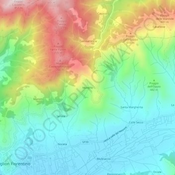
Name: Moriello topographic map, elevation, terrain.
Location: Moriello, Castiglion Fiorentino, Arezzo, Tuscany, 52043, Italy (43.33907 11.92809 43.37907 11.96809)
Average elevation: 454 m
Minimum elevation: 260 m
Maximum elevation: 825 m
Thank you for supporting this site ❤️
Make a donation
Make a donation
Gear up for your next adventure:
As an Amazon Associate, this site earns from qualifying purchases at no extra cost to you.