
Evere topographic map
Interactive map
Click on the map to display elevation.
About this map
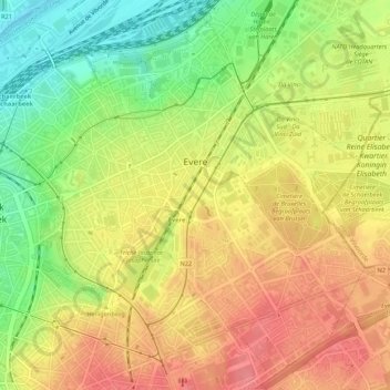
Name: Evere topographic map, elevation, terrain.
Location: Evere, Brussels-Capital, 1140, Belgium (50.85228 4.38772 50.88593 4.42664)
Average elevation: 53 m
Minimum elevation: 10 m
Maximum elevation: 87 m
Other topographic maps
Click on a map to view its topography, its elevation and its terrain.
Boitsfort - Bosvoorde
Belgium > Brussels-Capital > Watermael-Boitsfort - Watermaal-Bosvoorde
Average elevation: 96 m
Parc de Laeken - Park van Laken
Belgium > Brussels-Capital > Brussels > Laeken - Laken
Average elevation: 47 m
Molenbeek-Saint-Jean - Sint-Jans-Molenbeek
Belgium > Brussels-Capital > Molenbeek-Saint-Jean - Sint-Jans-Molenbeek
Average elevation: 47 m