Geolocate

القلعة topographic map

Interactive map

Click on the map to display elevation.

About this map

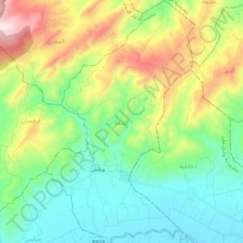
Name: القلعة topographic map, elevation, terrain.

Location: القلعة, معتمدية غار الدماء, Jendouba, Tunisia (36.48935 8.42479 36.61173 8.51820)

Average elevation: 484 m

Minimum elevation: 165 m

Maximum elevation: 1,200 m

Other topographic maps

Click on a map to view its topography, its elevation and its terrain.

ناظور

Tunisia > Jendouba

ناظور, معتمدية طبرقة, Jendouba, Tunisia

Average elevation: 340 m

Babouch

Tunisia > Jendouba > Babouch

Babouch, أولاد سدرة, عين دراهم, Jendouba, Tunisia

Average elevation: 527 m

مراسن

Tunisia > Jendouba > مراسن

مراسن, معتمدية غار الدماء, Jendouba, Tunisia

Average elevation: 285 m

الملقى

Tunisia > Jendouba

الملقى, معتمدية جندوبة الجنوبية, Jendouba, Tunisia

Average elevation: 141 m