
Parc Penallta topographic map
Interactive map
Click on the map to display elevation.
About this map
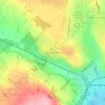
Name: Parc Penallta topographic map, elevation, terrain.
Location: Parc Penallta, Gelligaer, Caerphilly, Wales, United Kingdom (51.64453 -3.26954 51.65581 -3.24053)
Average elevation: 188 m
Minimum elevation: 97 m
Maximum elevation: 288 m
Other topographic maps
Click on a map to view its topography, its elevation and its terrain.
Gelligaer
United Kingdom > Wales > Gelligaer
Gelligaer, Caerphilly, Wales, United Kingdom
Average elevation: 202 m