
Tembali topographic map
Interactive map
Click on the map to display elevation.
About this map
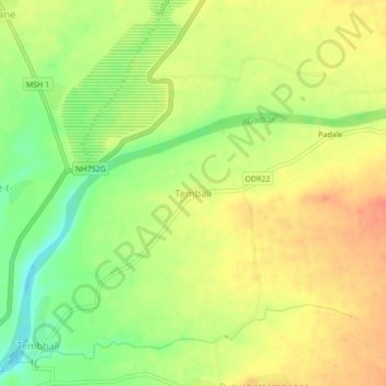
Name: Tembali topographic map, elevation, terrain.
Location: Tembali, Shahade, Nandurbar, Maharashtra, India (21.56952 74.48931 21.60952 74.52931)
Average elevation: 161 m
Minimum elevation: 133 m
Maximum elevation: 181 m
Other topographic maps
Click on a map to view its topography, its elevation and its terrain.