Geolocate

Second Al Hamra' topographic map

Interactive map

Click on the map to display elevation.

About this map

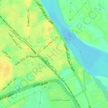
Name: Second Al Hamra' topographic map, elevation, terrain.

Location: Second Al Hamra', Asyut, 71513, Egypt (27.17563 31.18955 27.18389 31.19815)

Average elevation: 56 m

Minimum elevation: 44 m

Maximum elevation: 68 m

Other topographic maps

Click on a map to view its topography, its elevation and its terrain.

Sixth

Egypt > Asyut

Sixth, Asyut, 71511, Egypt

Average elevation: 57 m

Al Badari

Egypt > Asyut

Al Badari, Asyut, 71727, Egypt

Average elevation: 70 m

New Asyut

Egypt > Asyut

New Asyut, Asyut, 71684, Egypt

Average elevation: 93 m

Asyut

Egypt > Asyut

Asyut, Egypt

Average elevation: 57 m

First Al Hamra'

Egypt > Asyut

First Al Hamra', Asyut, Egypt

Average elevation: 54 m

Sidfa

Egypt > Asyut

Sidfa, Asyut, 71748, Egypt

Average elevation: 57 m