
Samstagern topographic map
Interactive map
Click on the map to display elevation.
About this map
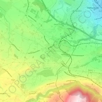
Name: Samstagern topographic map, elevation, terrain.
Location: Samstagern, Richterswil, Bezirk Horgen, Zürich, 8833, Schweiz (47.17216 8.65759 47.21216 8.69759)
Average elevation: 651 m
Minimum elevation: 405 m
Maximum elevation: 1,016 m