
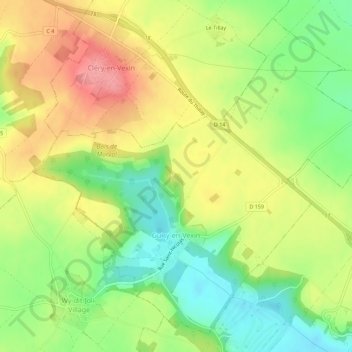
Guiry-en-Vexin topographic map
Interactive map
Click on the map to display elevation.
About this map
Name: Guiry-en-Vexin topographic map, elevation, terrain.
Average elevation: 132 m
Minimum elevation: 88 m
Maximum elevation: 178 m
Der Ort Guiry-en-Vexin liegt in einer Höhe von circa 100 m ü. d. M. circa 55 Kilometer (Fahrtstrecke) nordwestlich von Paris in der Landschaft des Vexin nahe der Grenze zur Normandie. Das Gemeindegebiet gehört zum Regionalen Naturpark Vexin français.