
Albanyà topographic map
Interactive map
Click on the map to display elevation.
About this map
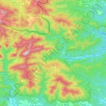
Name: Albanyà topographic map, elevation, terrain.
Location: Albanyà, Haut-Ampurdan, Gérone, Catalogne, 17733, Espagne (42.24585 2.54202 42.37968 2.75164)
Average elevation: 581 m
Minimum elevation: 165 m
Maximum elevation: 1,333 m