
Grosbous topographic map
Interactive map
Click on the map to display elevation.
About this map
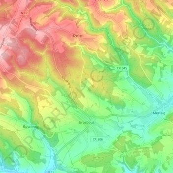
Name: Grosbous topographic map, elevation, terrain.
Location: Grosbous, Canton Redange, Luxembourg (49.80962 5.91500 49.87069 5.98731)
Average elevation: 397 m
Minimum elevation: 294 m
Maximum elevation: 531 m
Other topographic maps
Click on a map to view its topography, its elevation and its terrain.
Roodt
Roodt, Ell, Canton Redange, 8560, Luxembourg
Average elevation: 412 m