
Anthering topographic map
Interactive map
Click on the map to display elevation.
About this map
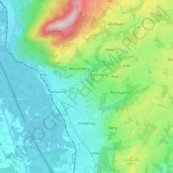
Name: Anthering topographic map, elevation, terrain.
Location: Anthering, Salzburg-Umgebung, Salzburg, 5102, Oostenrijk (47.86381 12.96646 47.92309 13.06001)
Average elevation: 509 m
Minimum elevation: 388 m
Maximum elevation: 836 m