Geolocate

Costa Rodi topographic map

Click on the map to display elevation.

About this map

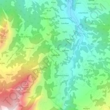
Name: Costa Rodi topographic map, elevation, terrain.

Location: Costa Rodi, Bettola, Piacenza, Emilia-Romagna, Italy (44.76812 9.48207 44.80812 9.52207)

Average elevation: 543 m

Minimum elevation: 232 m

Maximum elevation: 1,174 m

Gear up for your next adventure:

🛌Sleeping Bags - Warm and packable sleeping bags for outdoor nights
🧺Microfibre Travel Towels - Fast-drying and compact towels for wild swimming and camping
🥤Collapsible Water Bottles - Save space in your rucksack as you consume your water
🧭Professional Hiking Compasses - High-precision liquid-filled compasses for map reading and orientation
🧊Personal Water Filters - Drink safely from mountain streams marked on your map

As an Amazon Associate, this site earns from qualifying purchases at no extra cost to you.