
Heiderscheid topographic map
Interactive map
Click on the map to display elevation.
About this map
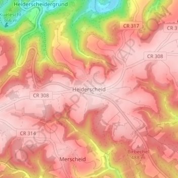
Name: Heiderscheid topographic map, elevation, terrain.
Location: Heiderscheid, Canton Wiltz, 9157, Luxembourg (49.86685 5.95742 49.90685 5.99742)
Average elevation: 444 m
Minimum elevation: 252 m
Maximum elevation: 521 m