

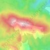
Kosatica topographic map
Click on the map to display elevation.
About this map

Name: Kosatica topographic map, elevation, terrain.
Average elevation: 1,057 m
Minimum elevation: 479 m
Maximum elevation: 1,612 m
Other topographic maps
Click on a map to view its topography, its elevation and its terrain.
Zlatar
Serbia > Central Serbia > Zlatibor Administrative District > Prijepolje Municipality
Zlatar (Serbian Cyrillic: Златар, pronounced [zlǎtaːr]) is a mountain range in southwestern Serbia, lying between towns of Prijepolje and Nova Varoš. Its highest peak is Velika krseva, 1,627 meters tall, peak next to Golo brdo. It belongs to Stari Vlah group of Dinaric Alps. Zlatar is bounded by…
Average elevation: 1,438 m