
Steinhöfel topographic map
Interactive map
Click on the map to display elevation.
About this map
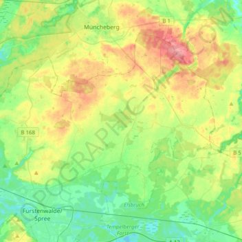
Name: Steinhöfel topographic map, elevation, terrain.
Location: Steinhöfel, Oder-Spree, Brandenburg, Deutschland (52.36213 13.97726 52.49890 14.28490)
Average elevation: 62 m
Minimum elevation: 33 m
Maximum elevation: 112 m