Geolocate

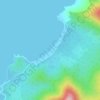
Inagawan Sub-Colony topographic map

Click on the map to display elevation.

About this map

Name: Inagawan Sub-Colony topographic map, elevation, terrain.

Location: Inagawan Sub-Colony, Puerto Princesa, Mimaropa, Philippines (9.54874 118.64954 9.58874 118.68954)

Average elevation: 9 m

Minimum elevation: -1 m

Maximum elevation: 100 m

Other topographic maps

Click on a map to view its topography, its elevation and its terrain.

Tagkawayan Beach

Philippines > Puerto Princesa

Average elevation: 48 m

Baywalk Park

Philippines > Puerto Princesa

Average elevation: 6 m

Bacungan River

Philippines > Puerto Princesa

Average elevation: 123 m

Irawan River

Philippines > Puerto Princesa

Average elevation: 120 m

Sabang River

Philippines > Puerto Princesa

Average elevation: 39 m

Manors Verdant

Philippines > Puerto Princesa

Average elevation: 5 m

Gear up for your next adventure:

🧰First Aid Kits - Essential safety kits for outdoor activities
🧊Personal Water Filters - Drink safely from mountain streams marked on your map
🔦Outdoor Torches - Reliable torches for night navigation
🧷Tenacious Repair Tape - Instant fix for torn tents, jackets, or dry bags
💧Hydration Reservoirs - Convenient water bladders for hands-free drinking on the move

As an Amazon Associate, this site earns from qualifying purchases at no extra cost to you.