Geolocate

Costa topographic map

Click on the map to display elevation.

About this map

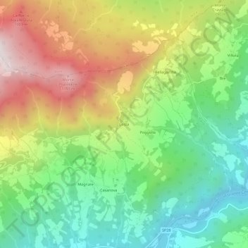
Name: Costa topographic map, elevation, terrain.

Location: Costa, Bardi, Parma, Emilia-Romagna, Italy (44.64809 9.78235 44.68809 9.82235)

Average elevation: 692 m

Minimum elevation: 313 m

Maximum elevation: 1,242 m

Gear up for your next adventure:

🔋Rechargeable Batteries - Eco-friendly power for headlamps and older GPS units
🌄Compact Monoculars - Lightweight optics for hiking
🔦Keychain LED Torches - Emergency backup light for finding gear in your pack
🦶Anti-Blister Balms - Protect your feet before long topographic expeditions
📸Action Camera Chest Mounts - Record your ascent following topographic paths hands-free

As an Amazon Associate, this site earns from qualifying purchases at no extra cost to you.