
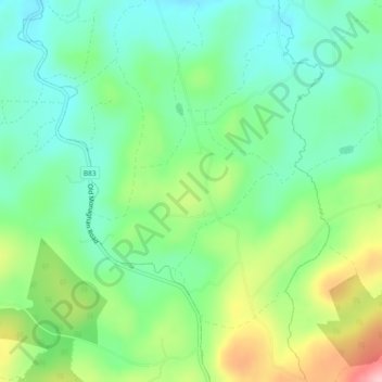
Cloonycoppoge topographic map
Interactive map
Click on the map to display elevation.
About this map
Name: Cloonycoppoge topographic map, elevation, terrain.
Average elevation: 129 m
Minimum elevation: 75 m
Maximum elevation: 238 m
Other topographic maps
Click on a map to view its topography, its elevation and its terrain.
Derryclay
Royaume-Uni > Irlande du Nord > Augher
Derryclay, Augher, County Tyrone, Irlande du Nord, Royaume-Uni
Average elevation: 74 m
Knockmany
Royaume-Uni > Irlande du Nord > Augher
Knockmany, Augher, County Tyrone, Irlande du Nord, Royaume-Uni
Average elevation: 119 m
Glennageeragh
Royaume-Uni > Irlande du Nord > Augher
Glennageeragh, Augher, County Tyrone, Irlande du Nord, Royaume-Uni
Average elevation: 137 m