
Lake topographic map
Interactive map
Click on the map to display elevation.
About this map
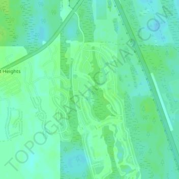
Name: Lake topographic map, elevation, terrain.
Location: Lake, Comté de Saint Johns, Floride, États-Unis d'Amérique (29.80256 -81.38224 29.81242 -81.37825)
Average elevation: 13 m
Minimum elevation: 8 m
Maximum elevation: 17 m
Other topographic maps
Click on a map to view its topography, its elevation and its terrain.
Palm Valley
États-Unis d'Amérique > Floride > Comté de Saint Johns > Ponte Vedra Beach
Palm Valley, Ponte Vedra Beach, Comté de Saint Johns, Floride, États-Unis d'Amérique
Average elevation: 4 m
Nocatee
États-Unis d'Amérique > Floride > Comté de Saint Johns
Nocatee, Comté de Saint Johns, Floride, 32081, États-Unis d'Amérique
Average elevation: 7 m
Solano Cove
États-Unis d'Amérique > Floride > Comté de Saint Johns
Solano Cove, Comté de Saint Johns, Floride, États-Unis d'Amérique
Average elevation: 3 m
Dupont Center
États-Unis d'Amérique > Floride > Comté de Saint Johns > Dupont Center
Dupont Center, Comté de Saint Johns, Floride, États-Unis d'Amérique
Average elevation: 9 m
Saint Augustine
États-Unis d'Amérique > Floride > Comté de Saint Johns > Saint Augustine
Saint Augustine, Comté de Saint Johns, Floride, 32084, États-Unis d'Amérique
Average elevation: 5 m
Collier-Blocker-Puryear Park
États-Unis d'Amérique > Floride > Comté de Saint Johns > College Park
Collier-Blocker-Puryear Park, College Park, Comté de Saint Johns, Floride, États-Unis d'Amérique
Average elevation: 11 m