
Holzem topographic map
Interactive map
Click on the map to display elevation.
About this map
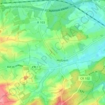
Name: Holzem topographic map, elevation, terrain.
Location: Holzem, Mamer, Canton Capellen, Luxembourg (49.59891 5.96347 49.63848 6.00194)
Average elevation: 316 m
Minimum elevation: 290 m
Maximum elevation: 374 m