
Bourglinster topographic map
Interactive map
Click on the map to display elevation.
About this map
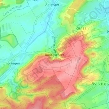
Name: Bourglinster topographic map, elevation, terrain.
Location: Bourglinster, Junglinster, Canton Grevenmacher, 6162, Luxembourg (49.68317 6.19753 49.72317 6.23753)
Average elevation: 348 m
Minimum elevation: 299 m
Maximum elevation: 416 m