
Ghazaouet topographic map
Interactive map
Click on the map to display elevation.
About this map
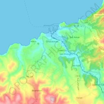
Name: Ghazaouet topographic map, elevation, terrain.
Location: Ghazaouet, Ghazaouet District, Tilimsen, Algeria (35.05621 -1.90250 35.11567 -1.80901)
Average elevation: 100 m
Minimum elevation: -1 m
Maximum elevation: 377 m