
Kurai Tahsil topographic map
Interactive map
Click on the map to display elevation.
About this map
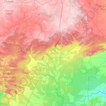
Name: Kurai Tahsil topographic map, elevation, terrain.
Location: Kurai Tahsil, Seoni, Madhya Pradesh, 480881, India (21.59494 79.22215 21.99674 79.79138)
Average elevation: 479 m
Minimum elevation: 284 m
Maximum elevation: 672 m
Other topographic maps
Click on a map to view its topography, its elevation and its terrain.
Turiya
India > Madhya Pradesh > Kurai Tahsil > Turiya
Turiya, Kurai Tahsil, Seoni, Madhya Pradesh, India
Average elevation: 428 m