Geolocate

Trevethin topographic map

Click on the map to display elevation.

About this map

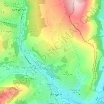
Name: Trevethin topographic map, elevation, terrain.

Location: Trevethin, Pontypool, Torfaen, Wales, United Kingdom (51.69860 -3.05881 51.73134 -3.02111)

Average elevation: 228 m

Minimum elevation: 105 m

Maximum elevation: 408 m

Torfaen trails, hiking, mountain biking, running and outdoor activities

Other topographic maps

Click on a map to view its topography, its elevation and its terrain.

Pontypool Park

United Kingdom > Wales > Torfaen > Pontypool

Average elevation: 162 m

Gear up for your next adventure:

🐕Hiking Dog Harnesses - Rugged harnesses for taking your companion on mountain trails
📷Camera Straps - Secure straps for carrying cameras while walking
💧Hydration Reservoirs - Convenient water bladders for hands-free drinking on the move
📍Handheld GPS Navigators - Reliable satellite navigation for hiking and off-road exploration
🥾Women's Waterproof Hiking Boots - High-performance trekking boots designed for all-weather comfort

As an Amazon Associate, this site earns from qualifying purchases at no extra cost to you.