
Thank you for supporting this site ❤️
Make a donation
Make a donation
Gear up for your next adventure:
As an Amazon Associate, this site earns from qualifying purchases at no extra cost to you.
Ahobilam topographic map
Click on the map to display elevation.
Thank you for supporting this site ❤️
Make a donation
Make a donation
Gear up for your next adventure:
As an Amazon Associate, this site earns from qualifying purchases at no extra cost to you.
About this map
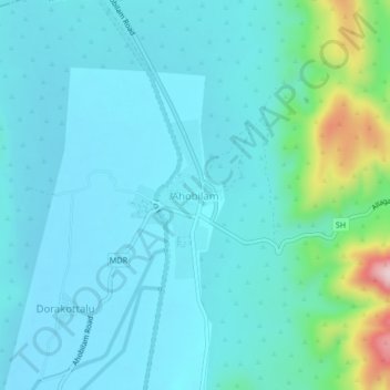
Name: Ahobilam topographic map, elevation, terrain.
Location: Ahobilam, Allagadda, Nandyal, Andhra Pradesh, 518545, India (15.11375 78.65488 15.15375 78.69488)
Average elevation: 269 m
Minimum elevation: 219 m
Maximum elevation: 549 m
Thank you for supporting this site ❤️
Make a donation
Make a donation
Gear up for your next adventure:
As an Amazon Associate, this site earns from qualifying purchases at no extra cost to you.