
Make a donation
Gear up for your next adventure:
As an Amazon Associate, this site earns from qualifying purchases at no extra cost to you.
Olive topographic map
Click on the map to display elevation.
Make a donation
Gear up for your next adventure:
As an Amazon Associate, this site earns from qualifying purchases at no extra cost to you.
Olive
Olive (also Rocky Point) is an unincorporated community in north central Powder River County, Montana, United States. It lies along Highway 59 northwest of the town of Broadus, the county seat of Powder River County. Its elevation is 3,232 feet (985 m).
Make a donation
Gear up for your next adventure:
As an Amazon Associate, this site earns from qualifying purchases at no extra cost to you.
About this map
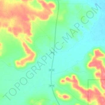
Name: Olive topographic map, elevation, terrain.
Location: Olive, Powder River County, Montana, United States (45.53004 -105.54855 45.57004 -105.50855)
Average elevation: 1,001 m
Minimum elevation: 969 m
Maximum elevation: 1,055 m
Make a donation
Gear up for your next adventure:
As an Amazon Associate, this site earns from qualifying purchases at no extra cost to you.