Geolocate

Rusinga Island topographic map

Click on the map to display elevation.

About this map

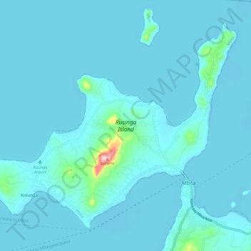
Name: Rusinga Island topographic map, elevation, terrain.

Location: Rusinga Island, Kolunga, Homa Bay County, Nyanza, Kenya (-0.44196 34.11854 -0.35164 34.22856)

Average elevation: 1,148 m

Minimum elevation: 1,130 m

Maximum elevation: 1,449 m

Gear up for your next adventure:

📢Survival Whistles - Essential safety gear for signaling for help in mountain fog
Altimeter Watches - Watches measuring altitude for mountain activities
🔋Solar Chargers - Eco-friendly charging solutions for outdoor use
🛰️Outdoor GPS Navigation - Navigation devices for remote and off-grid areas
🧢Hiking Hats - Sun and weather protection for outdoor walks

As an Amazon Associate, this site earns from qualifying purchases at no extra cost to you.