
Tsalka topographic map
Interactive map
Click on the map to display elevation.
About this map
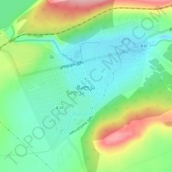
Name: Tsalka topographic map, elevation, terrain.
Location: Tsalka, Tsalka Municipality, Lower Kartli, Georgia (41.58333 44.06788 41.60858 44.10957)
Average elevation: 1,520 m
Minimum elevation: 1,459 m
Maximum elevation: 1,653 m