Geolocate

Balangcas topographic map

Click on the map to display elevation.

About this map

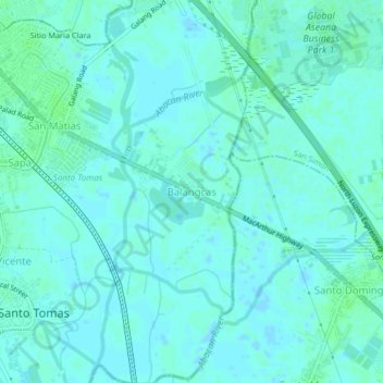
Name: Balangcas topographic map, elevation, terrain.

Location: Balangcas, Minalin, Pampanga, Central Luzon, Philippines (14.98145 120.70616 15.02145 120.74616)

Average elevation: 3 m

Minimum elevation: -2 m

Maximum elevation: 6 m

Gear up for your next adventure:

🕶️Glacier Goggles - Maximum protection for high-altitude snow topography
👟Heavy Duty Boot Laces - Always carry a spare for your hiking footwear
🛰️Handheld GPS Devices - Reliable GPS units for hiking and outdoor navigation
Lightweight Tents - Compact tents for backpacking and trekking
🛌Sleeping Bags - Warm and packable sleeping bags for outdoor nights

As an Amazon Associate, this site earns from qualifying purchases at no extra cost to you.