
Thank you for supporting this site ❤️
Make a donation
Make a donation
Gear up for your next adventure:
As an Amazon Associate, this site earns from qualifying purchases at no extra cost to you.
Großbreitenbach topographic map
Click on the map to display elevation.
Thank you for supporting this site ❤️
Make a donation
Make a donation
Gear up for your next adventure:
As an Amazon Associate, this site earns from qualifying purchases at no extra cost to you.
About this map
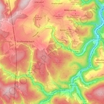
Name: Großbreitenbach topographic map, elevation, terrain.
Location: Großbreitenbach, Ilm-Kreis, Thuringia, Germany (50.54992 10.97003 50.59756 11.07645)
Average elevation: 596 m
Minimum elevation: 374 m
Maximum elevation: 744 m
Thank you for supporting this site ❤️
Make a donation
Make a donation
Gear up for your next adventure:
As an Amazon Associate, this site earns from qualifying purchases at no extra cost to you.