
Thank you for supporting this site ❤️
Make a donation
Make a donation
Gear up for your next adventure:
As an Amazon Associate, this site earns from qualifying purchases at no extra cost to you.
Terrat topographic map
Click on the map to display elevation.
Thank you for supporting this site ❤️
Make a donation
Make a donation
Gear up for your next adventure:
As an Amazon Associate, this site earns from qualifying purchases at no extra cost to you.
About this map
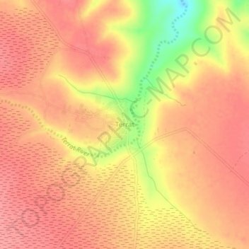
Name: Terrat topographic map, elevation, terrain.
Location: Terrat, Simanjiro, Manyara Region, Northern Zone, Tanzania (-3.90341 36.57739 -3.86341 36.61739)
Average elevation: 1,414 m
Minimum elevation: 1,352 m
Maximum elevation: 1,437 m
Thank you for supporting this site ❤️
Make a donation
Make a donation
Gear up for your next adventure:
As an Amazon Associate, this site earns from qualifying purchases at no extra cost to you.