
Skúvoy topographic map
Interactive map
Click on the map to display elevation.
About this map
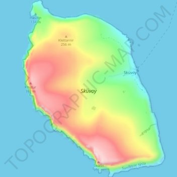
Name: Skúvoy topographic map, elevation, terrain.
Location: Skúvoy, Sandoy region, 260, Faroe Islands (61.74648 -6.85922 61.78739 -6.78971)
Average elevation: 97 m
Minimum elevation: -18 m
Maximum elevation: 397 m