
Goshute topographic map
Interactive map
Click on the map to display elevation.
About this map
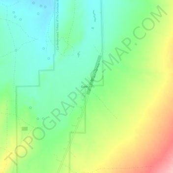
Name: Goshute topographic map, elevation, terrain.
Location: Goshute, Tooele County, Utah, USA (39.97644 -113.99843 40.01644 -113.95843)
Average elevation: 1,676 m
Minimum elevation: 1,622 m
Maximum elevation: 1,767 m