
Dangriga Town topographic map
Interactive map
Click on the map to display elevation.
About this map
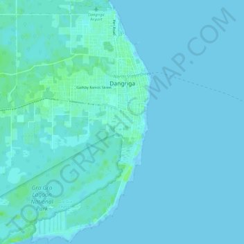
Name: Dangriga Town topographic map, elevation, terrain.
Location: Dangriga Town, Stann Creek District, Belize (16.93280 -88.25725 16.98411 -88.21833)
Average elevation: 2 m
Minimum elevation: -1 m
Maximum elevation: 10 m
Other topographic maps
Click on a map to view its topography, its elevation and its terrain.
Blue Ground Range
Blue Ground Range, Stann Creek District, Belize
Average elevation: 0 m