Geolocate

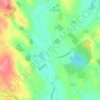
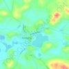
Conaghy topographic map

Click on the map to display elevation.

About this map

Name: Conaghy topographic map, elevation, terrain.

Location: Conaghy, Killeevan ED, Ballybay-Clones Municipal District, County Monaghan, Ulster, Ireland (54.18668 -7.15244 54.19847 -7.13991)

Average elevation: 67 m

Minimum elevation: 49 m

Maximum elevation: 119 m

Other topographic maps

Click on a map to view its topography, its elevation and its terrain.

Lough Egish

Ireland > County Monaghan

Average elevation: 158 m

Magheracloone

Ireland > County Monaghan

Average elevation: 57 m

Annayalla

Ireland > County Monaghan

Average elevation: 123 m

Newbliss

Ireland > County Monaghan > Newbliss

Average elevation: 115 m

Ballybay Town Park

Ireland > County Monaghan

Average elevation: 94 m

Lough Fea

Ireland > County Monaghan

Average elevation: 50 m

Tydavnet

Ireland > County Monaghan

Average elevation: 88 m

Inniskeen

Ireland > County Monaghan

Average elevation: 60 m

Gear up for your next adventure:

⌚GPS Outdoor Watches - Watches with GPS tracking for hiking and exploration
🔦Keychain LED Torches - Emergency backup light for finding gear in your pack
🦯Walking Poles - Supportive poles for long-distance walking
🖼️Topographic Map Art - Decorative 3D-effect posters of famous UK peaks and regions
🥤Hydration Bladders - Hands-free hydration systems for backpacks

As an Amazon Associate, this site earns from qualifying purchases at no extra cost to you.