Geolocate

Commanda topographic map

Click on the map to display elevation.

About this map

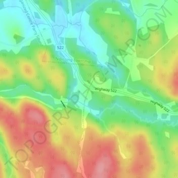
Name: Commanda topographic map, elevation, terrain.

Location: Commanda, Nipissing Township, Parry Sound District, Central Ontario, Ontario, Canada (45.94164 -79.61558 45.96164 -79.59558)

Average elevation: 299 m

Minimum elevation: 253 m

Maximum elevation: 355 m

Other topographic maps

Click on a map to view its topography, its elevation and its terrain.

Gear up for your next adventure:

👟Women's Trail Running Shoes - Agile footwear for fell running and technical trails
📱Phone Mounts for Hiking - Secure mounts to carry your phone on trails
🧭Emergency Beacons - Safety beacons for remote outdoor locations
🧷Tenacious Repair Tape - Instant fix for torn tents, jackets, or dry bags
📕Outdoor Navigation Books - Learn traditional and modern navigation techniques

As an Amazon Associate, this site earns from qualifying purchases at no extra cost to you.