Geolocate

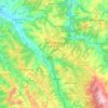
Pastine topographic map

Click on the map to display elevation.

About this map

Name: Pastine topographic map, elevation, terrain.

Location: Pastine, Barberino Tavarnelle, Florence, Tuscany, 50021, Italy (43.50413 11.11286 43.54413 11.15286)

Average elevation: 183 m

Minimum elevation: 83 m

Maximum elevation: 340 m

Other topographic maps

Click on a map to view its topography, its elevation and its terrain.

Barberino di Mugello

Italy > Tuscany > Florence

Average elevation: 495 m

San Casciano in Val di Pesa

Italy > Tuscany > Florence

Average elevation: 230 m

Piazza D'Azeglio

Italy > Tuscany > Florence > Florence

Average elevation: 61 m

Gear up for your next adventure:

🎿Telescopic Trekking Poles - Reduces knee strain on steep topographic descents
📦Dry Bags - Waterproof bags to protect gear from rain
🥤Hiking Water Bottles - Reusable bottles for hydration on the trail
📢Survival Whistles - Essential safety gear for signaling for help in mountain fog
👖Packable Overtrousers - Quick-deploy rain protection for legs in sudden storms

As an Amazon Associate, this site earns from qualifying purchases at no extra cost to you.