Geolocate

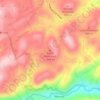
Columbus topographic map

Click on the map to display elevation.

About this map

Name: Columbus topographic map, elevation, terrain.

Location: Columbus, Polk County, North Carolina, United States (35.23478 -82.21909 35.30159 -82.17634)

Average elevation: 406 m

Minimum elevation: 277 m

Maximum elevation: 925 m

Other topographic maps

Click on a map to view its topography, its elevation and its terrain.
Beulah

United States > North Carolina > Polk County

Average elevation: 287 m

Mill Spring

United States > North Carolina > Polk County

Average elevation: 318 m

Mill Spring

United States > North Carolina > Polk County

Average elevation: 318 m

Peniel

United States > North Carolina > Polk County

Average elevation: 326 m

Cox

United States > North Carolina > Polk County

Average elevation: 251 m

Howard Gap

United States > North Carolina > Polk County

Average elevation: 573 m

Gear up for your next adventure:

🧴Tick Removal Tools - Small, essential health tool for UK woodland and moorland
❄️Walking Crampons - Added traction for icy slopes and winter peak bagging
🧤Thermal Touchscreen Gloves - Stay warm while operating your GPS or smartphone camera
🥾Men's Waterproof Hiking Boots - Durable footwear with deep lugs for muddy and rocky UK terrains
🧥Softshell Jackets - Breathable jackets for active outdoor use

As an Amazon Associate, this site earns from qualifying purchases at no extra cost to you.