Geolocate

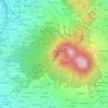
Ciemas topographic map

Click on the map to display elevation.

About this map

Name: Ciemas topographic map, elevation, terrain.

Location: Ciemas, Sukabumi, West Java, Java, Indonesia (-7.27290 106.47846 -7.19290 106.55846)

Average elevation: 225 m

Minimum elevation: 4 m

Maximum elevation: 477 m

Other topographic maps

Click on a map to view its topography, its elevation and its terrain.

Situ Gunung

Indonesia > West Java > Sukabumi > Kadudampit

Average elevation: 1,039 m

Cibodas

Indonesia > West Java > Sukabumi > Cimenteng

Average elevation: 260 m

Cikahuripan

Indonesia > West Java > Sukabumi

Average elevation: 110 m

Cisolok

Indonesia > West Java > Sukabumi

Average elevation: 62 m

Gear up for your next adventure:

🧢Thermal Beanie Hats - Prevent heat loss from the head in windy summit conditions
🧊Personal Water Filters - Drink safely from mountain streams marked on your map
🌂Windproof Trekking Umbrellas - Surprising but effective rain protection on low-wind trails
🔦Head Torches - Hands-free lighting for hiking and camping
🧴Tick Removal Tools - Small, essential health tool for UK woodland and moorland

As an Amazon Associate, this site earns from qualifying purchases at no extra cost to you.