
Make a donation
Gear up for your next adventure:
As an Amazon Associate, this site earns from qualifying purchases at no extra cost to you.
Hegebeintum topographic map
Click on the map to display elevation.
Make a donation
Gear up for your next adventure:
As an Amazon Associate, this site earns from qualifying purchases at no extra cost to you.
Hegebeintum
De terp van Hogebeintum werd bewoond vanaf 600 voor Christus. Het dorp waarin de terp stond wordt reeds in de 9e eeuw genoemd als 'Bintheim'. In de 10e eeuw is het dorp blijkbaar gesplitst, want er is dan sprake van een 'Westerbintheim' en een 'Osterbinetheim' (Oosterbeintum). Westerbeintum wordt vanaf de 15e eeuw Hogebeintum genoemd. Hoge verwijst naar de hoogte van de wierde en Beintum naar buntgras, een grassoort die nu niet meer voorkomt bij het dorp.
Make a donation
Gear up for your next adventure:
As an Amazon Associate, this site earns from qualifying purchases at no extra cost to you.
About this map
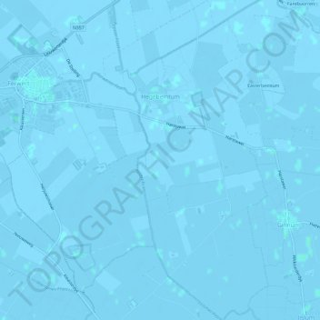
Name: Hegebeintum topographic map, elevation, terrain.
Location: Hegebeintum, Noardeast-Fryslân, Fryslân, Nederland (53.31193 5.83997 53.34738 5.87079)
Average elevation: -1 m
Minimum elevation: -3 m
Maximum elevation: 2 m
Make a donation
Gear up for your next adventure:
As an Amazon Associate, this site earns from qualifying purchases at no extra cost to you.
Other topographic maps
Click on a map to view its topography, its elevation and its terrain.
Make a donation
Gear up for your next adventure:
As an Amazon Associate, this site earns from qualifying purchases at no extra cost to you.
Make a donation
Gear up for your next adventure:
As an Amazon Associate, this site earns from qualifying purchases at no extra cost to you.
Make a donation
Gear up for your next adventure:
As an Amazon Associate, this site earns from qualifying purchases at no extra cost to you.
Make a donation
Gear up for your next adventure:
As an Amazon Associate, this site earns from qualifying purchases at no extra cost to you.
Skilleard
Schillaard werd in 1445 vermeld als Scallaert, in 1478 als Schillaerdt, in 1482 als Schellart en in 16e en 17e eeuw als Schillaerd. De plaatsnaam zou mogelijk verwijzen naar een terp (werth) bij een schelpenbank (skil-schelp). Een andere mogelijke betekenis is dat de terp/wierde scheef weglopend was, waarbij…
Average elevation: 0 m
Make a donation
Gear up for your next adventure:
As an Amazon Associate, this site earns from qualifying purchases at no extra cost to you.
Make a donation
Gear up for your next adventure:
As an Amazon Associate, this site earns from qualifying purchases at no extra cost to you.
Laaxum
In 1718 stonden er acht huizen in de buurtschap en in 1851 zes. Aan het begin van de twintigste eeuw was Laaxum een plaats met zestien huizen en twee boerderijen, waarin samen meer dan honderd mensen woonden. In het begin van de eenentwintigste stonden er elf huizen en één boerderij. De haven werd ook wel…
Average elevation: 0 m
Make a donation
Gear up for your next adventure:
As an Amazon Associate, this site earns from qualifying purchases at no extra cost to you.
Make a donation
Gear up for your next adventure:
As an Amazon Associate, this site earns from qualifying purchases at no extra cost to you.
Make a donation
Gear up for your next adventure:
As an Amazon Associate, this site earns from qualifying purchases at no extra cost to you.