
La Gasca topographic map
Interactive map
Click on the map to display elevation.
About this map
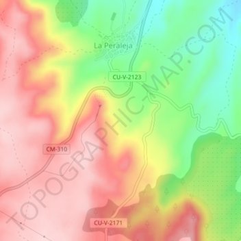
Name: La Gasca topographic map, elevation, terrain.
Location: La Gasca, La Peraleja, Cuenca, Castilla-La Mancha, España (40.21691 -2.56456 40.23691 -2.54456)
Average elevation: 941 m
Minimum elevation: 811 m
Maximum elevation: 1,041 m