Geolocate

Aring topographic map

Click on the map to display elevation.

About this map

Name: Aring topographic map, elevation, terrain.

Location: Aring, Mathura, Uttar Pradesh, 281500, India (27.46400 77.50824 27.50400 77.54824)

Average elevation: 181 m

Minimum elevation: 178 m

Maximum elevation: 183 m

Other topographic maps

Click on a map to view its topography, its elevation and its terrain.
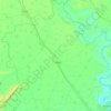
Chhata

India > Uttar Pradesh > Mathura

Average elevation: 184 m

Gear up for your next adventure:

🧤Waterproof Overmitts - Extreme weather protection for hikers and mountaineers
🪢Paracord - Multi-purpose cord for camping and survival
🔭Compact Hiking Binoculars - Lightweight optics for scouting terrain and spotting wildlife
🛌Insulated Sleeping Mats - Crucial thermal protection when sleeping on cold, uneven ground
🌄Outdoor Binoculars - Compact binoculars for landscape observation

As an Amazon Associate, this site earns from qualifying purchases at no extra cost to you.