Geolocate

Ollomont topographic map

Click on the map to display elevation.

About this map
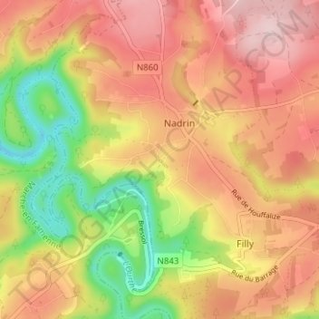
Name: Ollomont topographic map, elevation, terrain.

Location: Ollomont, Nadrin, Houffalize, Bastogne, Luxembourg, Wallonia, 6660, Belgium (50.13614 5.65710 50.17614 5.69710)

Average elevation: 376 m

Minimum elevation: 240 m

Maximum elevation: 479 m

Other topographic maps

Click on a map to view its topography, its elevation and its terrain.

Tailles

Belgium > Luxembourg > Bastogne > Houffalize

Average elevation: 541 m

Wibrin

Belgium > Luxembourg > Bastogne > Houffalize

Average elevation: 428 m

Gear up for your next adventure:

🎒Hiking Daypacks - Compact backpacks ideal for short hikes and excursions
🛌Sleeping Bags - Warm and packable sleeping bags for outdoor nights
🧊Insulated Flasks - Keeps drinks hot or cold during hikes
🛌Insulated Sleeping Mats - Crucial thermal protection when sleeping on cold, uneven ground
🐕Dog Hiking Gear - Equipment for hiking safely with dogs

As an Amazon Associate, this site earns from qualifying purchases at no extra cost to you.