Geolocate

Pomacle topographic map

Click on the map to display elevation.

About this map
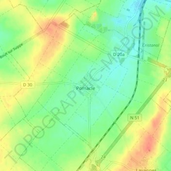
Name: Pomacle topographic map, elevation, terrain.

Location: Pomacle, Reims, Marne, Grand Est, Metropolitan France, 51110, France (49.31721 4.11596 49.35483 4.18446)

Average elevation: 98 m

Minimum elevation: 79 m

Maximum elevation: 123 m

Other topographic maps

Click on a map to view its topography, its elevation and its terrain.

La Chaussée de Damery

France > Grand Est > Marne

Average elevation: 136 m

Reims

France > Grand Est > Marne > Reims

Average elevation: 130 m

Le Mesnil le Huttier

France > Grand Est > Marne > Festigny

Average elevation: 176 m

Les Vingt Verges

France > Grand Est > Marne > Mareuil-le-Port > Le Mornas

Average elevation: 115 m

Gear up for your next adventure:

🥾Hiking Boots - Waterproof and durable boots for long-distance hiking in the UK
🛰️Satellite Messengers - Emergency communication devices for areas without mobile signal
🥾Women's Waterproof Hiking Boots - High-performance trekking boots designed for all-weather comfort
🎒Hiking Backpacks - Comfortable backpacks for day hikes and multi-day treks
🐕Dog Hiking Gear - Equipment for hiking safely with dogs

As an Amazon Associate, this site earns from qualifying purchases at no extra cost to you.