Geolocate

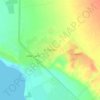
At Tur topographic map

Click on the map to display elevation.

About this map
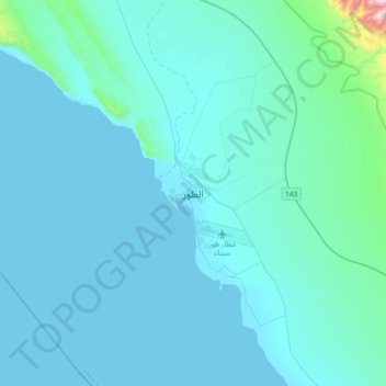
Name: At Tur topographic map, elevation, terrain.

Location: At Tur, South Sinai, 46511, Egypt (28.08167 33.46361 28.40167 33.78361)

Average elevation: 83 m

Minimum elevation: 0 m

Maximum elevation: 1,394 m

Other topographic maps

Click on a map to view its topography, its elevation and its terrain.
Ras Sudr

Egypt > South Sinai

Average elevation: 17 m

Ras Muhammad National Park

Egypt > South Sinai

Average elevation: 112 m

Abu Galum Protectorate

Egypt > South Sinai

Average elevation: 632 m

Ras Sudr

Egypt > South Sinai

Average elevation: 17 m

Al Tour City

Egypt > South Sinai

Average elevation: 50 m

Wadi Khuraytah

Egypt > South Sinai > Saint Catherine

Average elevation: 1,323 m

Gear up for your next adventure:

🧦Merino Wool Hiking Socks - Moisture-wicking socks to prevent blisters during long mountain walks
🗺️Topographic Maps - Detailed maps showing elevation and terrain features
🥾Trekking Poles - Poles to improve stability on uneven terrain
🌄Compact Monoculars - Lightweight optics for hiking
🗺️Ordnance Survey Maps - Essential paper maps for hiking across the UK national parks

As an Amazon Associate, this site earns from qualifying purchases at no extra cost to you.